Tripoli

Tripoli

Tripoli is considered the largest city of Libya, in addition to being the country’s capital. It is a well developed city, highlighted with Italianate style of architecture in their old establishments. It is also the primary seaport of the country and the center of commercial productions. For this reason, you can expect that the city has the busiest streets in Libya as well as many tourist attractions. Take note of the following destinations that must be visited upon touring around Tripoli:

• Jamahiriya Museum
This is the country’s national museum. It is home to many artifacts of Libya’s historical past including those from the Roman and Greek period of the country’s history, treasures recovered from their World Heritage Sites and the memorabilia of their recent political past.

• Gurgi and Karamanli Mosques
These mosques are the fruit of the local’s artistic abilities. Overall, it has a very good sense of architecture which is picturesque as well.

• Assaraya al-Hamra
This castle is also known as the Red Castle. It has a wide courtyard where various fountains and statues originating from the Ottoman period. The palace reflects the country’s rich historical past as shown in their architectural style of structures.

Aside from the above mentioned places to visit, there are still many tourist destinations around the city. After a tiring tour, it is advisable to visit the Bazaar where traditional products can be purchased. Looking at the cultural merchandise here can be very relaxing and interesting.


Tripoli (disambiguation).
Tripoli
Find Lebanese from Tripoli!

Mount Ararat

Mount Ararat

The city life can take its toll on any visitor. Most people need a change in scenery in order to recharge themselves and provide the perfect relief.

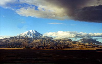
Going to a place with arresting scenery is just what people need to forget the city for a while, and in Turkey, such sceneries are abundant. Among those is Mt Ararat in the easternmost province of Anatolia, Turkey. Also called as Mount Masis in Armenian language, the dormant volcano is a sight to behold with its snow-capped peaks: the Greater Ararat and the Lesser Ararat.

Aside from being a picturesque volcano, Mt Ararat holds great Biblical significance. For years, people have believed that this is the mountain where Noah was said to have settled. Those who have been keen to prove this fact have held expeditions to the mountain in the hopes of finding remains of Noah’s ark. The description in the Bible was “mountains of Ararat”, thus sparking interest among those who wish to substantiate their faith.

Regardless whether the story concerning Noah and Mt Ararat is true or not, tourists can surely appreciate the beauty of this mountain. Seeing the peaks from afar is already a wondrous experience, but hiking to the mountain gives the adventurous travelers a different high.

Climbing Mt Ararat could be a once in a lifetime feat that no traveler would forget, so it is best to prepare months before attempting to hike. Travelers must secure a climbing permit and coordinate with a certified guide, as the Turkish government is keen on these requirements. About two months are needed to arrange everything.

Those wishing to climb Mt Ararat would have an easier time in the late summer, as long as they are fairly handy with the use of axe and crampons. The climb is not a walk in the park, but is said to be less taxing when visiting climbers take the way from the south. The climb may pose a challenge, but travelers will eventually realize that the effort is well worth it.


Mount Ararat 1999 - Courtesy
Mount Ararat
Ark of Noah on Mount Ararat

Dunedin

Dunedin

Dunedinis one of New Zealand’s four main centers. It is the second largest city in the South Island and is coined as the Edinburgh of the South with proud Scottish ancestry. It became the capital of the Otago province in 1852 and upon the discovery of gold in Gabriel’s Gully; people who came from different countries, such as Irish, Italian, Chinese, and German have frequented it.

In 1900, it no longer was the largest country in New Zealand. It began mellowing down and aging in a graceful way that writers and artists began to realize its charm.

Dunedin’s weather is known for occasional snowfalls in the winter, which gradually clears during the day. It has a temperate climate that shows the beauty of Dunedin in all four seasons.

Food and Dining

There are many choices for good food and fine dining in Dunedin. It has bars and pubs that offer a relaxing and atmospheric ambiance that is standard in the area. Restaurants offer a wide range of cuisine ranging from the traditional meals to the contemporary al fresco.

The style and atmosphere of Dunedin restaurants are characterized by the tastiest meals and the most elegant interior designs. Cafés offer a wide range of food selection that caters to both vegetarians and non-vegetarians alike.

Sights and Activities

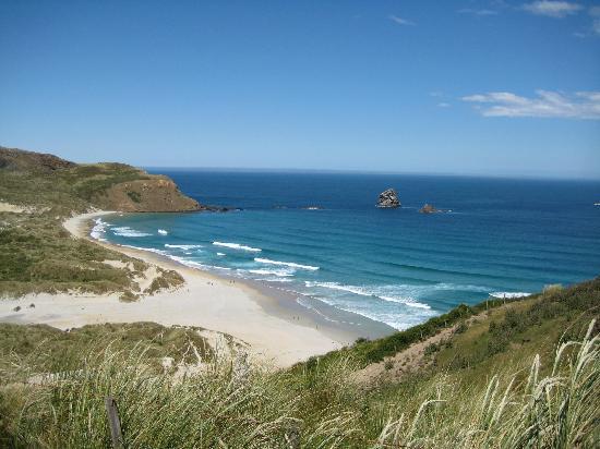
Surfing and swimming are among the main attractions in Dunedin. You could also go hiking on Baldwin Street, the steepest street in the world.

Places to Visit

1.Cadbury World. It is one of the largest factories in Dunedin, which is run by the Cadbury Chocolate Company. It offers tours for visitors to explore and experience the wonderful world of chocolate and Cadbury’s legacy.

2.Fortune Theatre. A popular repertory theater located in Moray Place, south of Dunedin.

3.The Octagon. The plaza which is the location of some of Dunedin’s important buildings and institutions. Buildings include the St. Paul Cathedral, Dunedin Town Hall, Regent Theatre, and Public Library.

4.The Otago Peninsula. A scenic coastline in Dunedin that showcases the beauty of nature as well as its wildlife. Seals and sea lions usually frequent this area.

5.Dunedin Botanical Garden. A garden with an aviary and offers themed gardens such as the Rhododendron, Azalea, and Rose gardens.

6.Larnach Castle. The only castle in New Zealand. It is basically a manor with a scandalous and tragic history due to the death of its owner, the banker, William Larnach. It has a haunted feel into it and offers a nice collection of local antiques. More than this, its carved ceilings are magnificently created by the best in Europe and it offers a spectacular view of Dunedin, Otago Peninsula, and the Pacific Ocean.


Dunedin travel guide -
Dunedin
Dunedin Vacations - 56 hotels

Tyre City

Tyre City

The city of Tyre is located to the south of Lebanon city and it is one of the major cities in the Phoenician era. The city extends up to the Mediterranean Sea and it is about 80 km from the Beirut city. The Tyre city is Lebanon’s fourth largest city with a population of about 318,000.

Mythology places Tyre as the home of Elissa and Europa, and features one of the major ports in the nation. It is a major tourist stop because of the numerous ancient sites, among them, is the famous Roman Hippodrome. Tyre is included in the UNESCO World Heritage Site for its historical constructions.

The city features a number of monuments dating back to 1500 BC; the people of this period were the world’s leading merchants. The city is also famous for its manufacture of the Tyrian purple dye which was mainly used the emperors of that period. Around 1000 BC during the reign of King David there was a friendly relation in between the people of Tyre and Hebrews.

Also at this city, a Syrian woman’s daughter was healed by Jesus Christ mentioned in Mark 7:24.

Tyre features three archaeological sites that include the Byzantine mosaic floor of an ancient church, Roman Cemetery and Roman triumphal arch. Among the ruins in the city is the hippodrome, the best preserved area that accommodates up to about 20,000 spectators.

In addition the city also features a number of ruins belonging to the Byzantine and Arabs. The other major sites are the Shia Mosque with double domes, Christian quarter and colorful souk.


Tyre has its own charm.
Tyre City
Tyre City

Kirkjubaejarklaustur

Kirkjubaejarklaustur

In 1973, Mt. Laki erupted. It was catastrophic; lava came down from the mountains and destroyed farms and bridges. However, for some reason, the lava flow unexpectedly stopped at site near a small church. The locals believed that it is their faith that saved them, and named the townKirkjubaejarklaustur, which, when translated roughly, means “church farm cloister”. To this day, the edge of that flow can still be sighted in the nearby village.

One of the attractions in Kirkjubaejarklaustur, Iceland is the Steingrímsson memorial chapel, which was named after the pastor whose sermon was believed to be the reason why the town was spared. Another is the Kirkjugólf, a hexagonal formation of basalt rocks which looks like a platform or a foundation of some sort.

Just outside Kirkjubaejarklaustur, Iceland is the Systrafoss, a waterfall and Systrastapi (the Sisters’ Pillar), where two nuns were burned at the stake and was buried, or so, the story goes. You would also get a view of quaint farms and villages.

Most tourists drop by Kirkjubaejarklaustur, Iceland as part of their itinerary when visiting the Laki craters – the very same craters that resulted from the 1783 eruption. If you want to really go “deep”, you need to use a four-wheel drive for transportation because the road is rather rough. Not very far from the site of the craters is the Fjarðrargljúfur canyon, which can be accessed by a smaller vehicle. Seen from above, the view of rock formations is a treat to the eyes.

Iceland has a lot to offer – a rich culture, an active night life, great fishing spots, whale-watching and bird watching sites. However, it’s the breathtaking natural beauty that draws people from all over. If you visit Kirkjubaejarklaustur, you will see a see a slice of heaven that is Iceland.


Kirkjubaejarklaustur the
Kirkjubaejarklaustur
Kirkjubaejarklaustur Southern

Mission Basilica San Diego De Alcala

Mission Basilica San Diego De Alcala

For lovers of California history and religious landmarks,San Diego’s MissionBasilica de Alcalais a place that has to be a staple when touring the city. Built in 1769 above old town, the Basilica is the first link of what will eventually become 21 chains of Spanish missions founded in California by Franciscan friar Junipero Serra. This first mission and the areas surrounding it were long inhabited by Kumeyaay Indians. The Spanish then named it after the Catholic Saint Didacus more commonly known as San Diego. Thus the Basilica marks one of the first landmarks associated with San Diego tying it from then on to the city’s rich history.

From its original location in Old Town, the Mission was moved to its present site in Mission Valley where it was sacked by the local tribe the year after it was built. This prompted Serra to use thick adobe walls and clay tile roofs in the reconstruction so that it will be harder to set ablaze, a move that has inspired 20th Century California architects.

The rich history includes its role as the site of many firsts in California history such as the first Christian burial and the first public execution in 1778. Also, California’s first Christian martyr, Father Luis Jayme is laid down to rest beneath the chancel floor. All these important connection to the history of San Diego and California in general have made Mission Basilica de Alcala a National Historic Landmark.

Today, the Basilica houses a museum as well as a gift shop where tourists can get their souvenirs. These are open daily from 9 am to 5 pm and can be easily reached via bus or trolley. Catholic masses are also said daily.


Mission Basilica San Diego de
Mission Basilica San Diego De Alcala
MISSION BASILICA SAN DIEGO DE

Boutilimit

Boutilimit

The weather is just right at Boutilimit, Mauritania so no need to worry of suffering from a heat stroke. The typical climate is sunny with little episodes of rainfall. With this in mind, why not leave your iced-cap place and head to where there is sexy heat and glorious sand? Sure enough, this place is one of the tourist’s destinations when they’re currently experiencing extreme weather. Summer forever is the most often comment of the locals who live in Boutilimit.

Who can blame them for being in the best place in town to market handicrafts that they themselves have made? You could go crazy over the array of rugs that were made by using camel hair or even goat hair! It does not smell bad at all since you will be amazed as to how perfect these rugs are and of course how soft. You could also avail of silver bangles, chains and other forms of souvenir items that are made in silver.

Don’t get shocked at the means of transportation. Here in Boutilimit, locals and tourists as well, share taxi cabs. They are not like the trusted yellow cab that you could get for your personal use. They treat their cabs like buses wherein they can load up as much as five passengers at a time. Although worry not that you would be traveling for days just to get your turn to be driven for. There is a common route to be followed for that specific ride.


Mauritania / Boutilimit
Boutilimit
Between Kiffa and Boutilimit

Copper Canyon

Copper Canyon

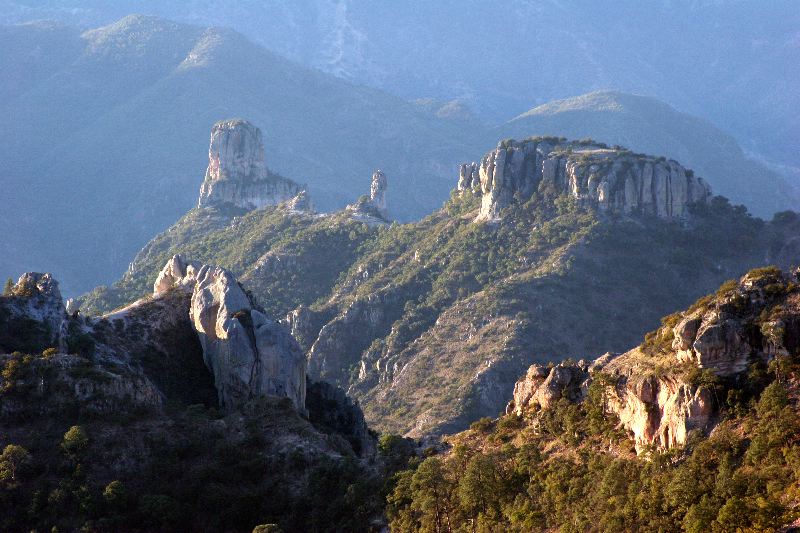
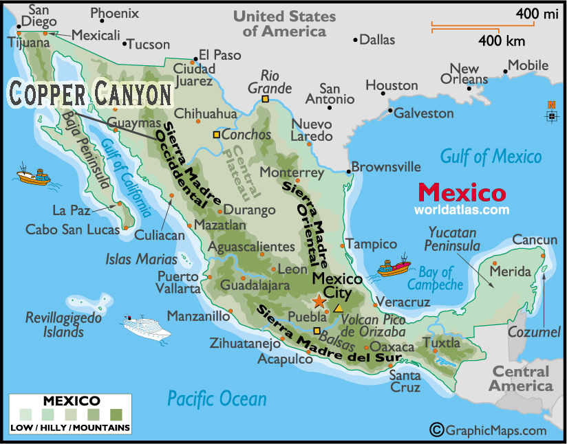
When it comes to natural attractions, Mexico is a haven. Natural wonders abound in this country, and one of them is the Barranca del Cobre, or Copper Canyon in English. The Copper Canyon, located in the state of Chihuahua in Mexico, is a group of six canyons joined together in the Sierra Tarahumara range. Visitors would be surprised to find out that this system of canyons is actually bigger (actually, at least four times larger) than what is considered to be the world’s most breathtaking collection of canyons – the Grand Canyon in the United States. The Copper Canyon was formed in Sierra Tarahumara’s western portion by six rivers which drain in that area. The six rivers merge into the Rio Fuerte and empty into the Cortez Sea. This system of canyons got its name from its walls, which were a copper/green color.

There are two types of weather in the canyon – the mountainous regions have an alpine climate that has moderate temperatures from October until November and March until April. Be amazed by the lush species of pine and the colors of wildflowers the blossom here. Meanwhile, the canyon’s bottom regions have subtropical weather, which means it is rainy there the whole year except from April through June, when it is very warm. You can see huge fig and palm plantations in this area.

There are so many things to do in Copper Canyon. Aside from having your breath taken away by the panoramic view of the canyon, you can also make an event out of getting to the canyons. You may hike, dirt bike, drive, and even go horseback riding when exploring the canyon. Of course, if you’re most of the luxurious type who just wants to take kin the beauty of the view, you can take the train. Along the rail path, you can see a lot of Tarahumara Indians selling indigenous wares and foodstuff.


Copper Canyon in Mexico
Copper Canyon
Copper Canyon (Barranca del

Juliasdale

Juliasdale

Juliasdale is a town located in Manicaland, Zimbabwe. The town is most famous for being the place where the first ever casino in the country was opened. However, that is not the only reason for people to visit Juliasdale. The mountainous Eastern Highland around the area provides tourists some lovely places to visit.

Places to visit:

• Ziwa Ruins – Among the ruins located near Juliasdale, the Ziwa ruins are the most popular and the most impressive. In 1946, it was declared as a National Monument; discussion is still going on whether the Ziwa Ruins will be listed as a World Heritage. It contains numerous ancient stone structures as well as pottery.

• The Eastern Highland – It is a mountain range located on the eastern side of Zimbabwe. The highland itself is a wondrous sight to behold but there are many places inside the area that attracts tourists. There’s the Mutarazi Falls, Africa’s second longest waterfall. The Honde Valley where the Pungwe and Honde River are located; it is quite steep. There are an abundance of tea and coffee growing in the Honde Valley due to its climate and topography. The famous Mutarazi Falls is also located in the Honde Valley which constantly attracts tourists.

• Nyanga National Park – Though it is located in Nyanga, a separate town, Juliasdale is really close and it is the last town tourists pass through to get to the park. There are many activities in the National Park such as hiking, camping, fishing, horse riding and boating. There are also numerous rivers and dams located in the park.


Juliasdale RHC1 Juliasdale
Juliasdale
Amy's Family Home - Juliasdale by TravelPod Member Ccinafrica

Roman Gladiators

In ancient Rome,Gladiatorswere armed combatants who would fight, often to the death, to entertain. Gladiator in latin means ‘swordsman’, derived from the word gladius (sword). Gladiators were introduced to Rome in the 3rd Century BC and reached its peak between the 1st century BC and 2nd century AD. However, the gladiator games lost their popularity towards the start of the 5th century.

Gladiator games (called ‘munera’) started as ‘duties’ paid to the dead ancestors but gradually lost their connection with the funeral of individuals. They became important public spectacles, which were staged by the politicians and the emperors. The popularity of gladiatorial games was enormous and famous gladiators became idols to the public.

Who were they?

Gladiators came from diverse backgrounds. Usually, Gladiators were men, but there could also be women. Most of the gladiators were prisoners of war or slaves and thrown in to the arena unwillingly, but their number included emperors. Free men, who were in dire need of money and lacked other means of support, voluntarily took a career as gladiator in hope of winning enough money and earn freedom for themselves.

As these games became more popular, many people later on joined to become gladiator for the fame and heroic status attached with the games. These men wanted to be popular and being a gladiator did offer a chance to become one. Anyone who chose to become a gladiator was considered to be beneath the law and not a respectable citizen. Though a few upper-class people did compete in the arena, but they did not live with other gladiators or like other gladiators. All gladiators were supposed to take an oath that they will endure to be burned, to be bound, to be beaten and to be killed by the sword.

Gladiators were trained in special training schools and the trained gladiators had a better chance of surviving the games and even thriving. Some gladiators had to fight no more than 2 to 3 times a year and top ones became popular heroes. Skilled gladiators stood a chance of winning good amount of money and even the wooden sword (rudis) that symbolized freedom. Freed gladiators either became trainers in the gladiatorial schools or bodyguards for wealthy individuals.

Types of Gladiators

There were various types of Gladiators categorized based on how they fought, their armor, and weapons. There were gladiators in chariots, horseback gladiators, gladiators who fought in pairs, and gladiators named after their origin. Gladiators were not only men but also few women took part in the games. Following were some of the different types of gladiators:

Thracian– These gladiators wore huge crested helmet with visor, high greaves on both legs, arm protectors and sported a short, curved sword.

Retiarius– These gladiators were net and trident fighters. They wore minimal amount of armor on the body and their head and neck used to be uncovered. Lack of armor made them more mobile and they used running as one of the tactics to fight against the opponents.

Secutor– They were generally paired with Retiarius and were often referred to as chasers. They had egg-shaped helmet with eye holes. For protection they had greaves on one leg, arm protector and legionary-style shield and sword.

Bestiarius– They were special type of gladiator trained to fight and kill various types of animals. They were the lowest ranked gladiators and did not become as popular as some other types of gladiators. These gladiators were mostly without armor and were equipped with whips or spears.

Most gladiator fights were conducted between different types of gladiators with different set of fighting equipment and armor.

Training

The manager or trainer of a gladiator group was called a ‘lanista’. He provided lengthy and arduous training in schools (called ‘ludi’), especially designed for this purpose and they were usually located near the great amphitheatres. At the peak of the gladiator games, all the gladiatorial schools in Rome were under direct control of the emperor. The biggest of these schools, the Ludus Magnus, was located in the vicinity of the Colosseum. This school even had a mini amphitheatre for practice and it’s remains can still be found.

A typical day at arena

The gladiator fights took place at arenas or amphitheatres. In the beginning, only privileged people were allowed in the arena, but over a period of time gladiator fights became a ticketed system. Gladiatorial games were kicked off with elaborate procession that included contestants and the sponsors of the games. The morning events used to begin with mock fights. These were followed by animal performances, where trained animals were featured to perform tricks. Also, exotic animals were pitted against each other for fights or they were hunted by Bestiarii.

During the lunch break, criminals were executed in the public arena. They were thrown in front of animals or were pitted against gladiators where their chance of survival was very low.

The afternoon session used to be the high point in the games that involved individual gladiatorial combat. In these matches, Gladiators with different combat styles and varied armor and weapons were pitted against each other. During the match, many rituals were followed in the arena, like holding up the index finger when the gladiator was wounded to concede defeat.

According to written evidence, ‘pollicem vertere’ (that includes turning the thumb) used to mean kill whereas ‘pollicem premere’ (that involves pressing the thumb) meant spare. People who turned or waved their thumbs meant that they want the gladiator to be killed; and people who wanted the gladiator to be spared would press their fists. In the end, it was sponsor’s decision whether to give life to the gladiator.

Since many centuries, gladiators have fascinated people, especially when they were fighting against cruel masters. That is the reason why character gladiator was introduced in many movies and was applauded by the audience.

Gladiator has been visualized in various art works of artists of Rome. Roman culture and art depicts the image of gladiator in their work. Paintings of gladiators were used to decorate the walls. ‘Pollice Verso’, Gerome’s painting beautifully portrays the image of rebellious gladiator. Wall paintings, lamps and ceramics made during the Roman Empire reflected the popularity of gladiatorial combat. Despite the fact that gladiators disappeared several centuries ago, their stories still continue to fascinate us.

Flag of Tanzania

Flag of Tanzania

The flag ofTanzaniahas a similarity with the rest of the nations in Africa: adaptation from the Pan-African colors. The Tanzanian flag uses five diagonal shapes – the topmost stripe is colored by green, an equal-sized diagonal stripe blue at the bottom and a black diagonal stripe at the centermost part, separated by two narrow strips of yellow which likewise served as a division from the green and blue colors.

The explanation behind the colors of the Tanzanian flag has marked connection with its geography, people, wealth and aspirations. The green color represents agriculture, rich vegetation and the fertility of the Tanzanian soil. The blue color indicates the numerous rivers and lakes traversing the Tanzanian land and the vastness of the Indian Ocean situated at the eastern part of Tanzania.

Likewise, the black color at its center symbolizes the people of African descent and the land they toiled for centuries. The yellow narrow stripes on both sides of the black stripe show the rich mineral wealth of Tanzania. As for the construction details of the flag the measure of the stripes are as follows: black is more than a 1/4 out of the size of the flag, the width of the two yellow bands is a third of each side.

As history will tell, the country of Tanzania is a consolidation of Zanzibar and Tanganyika. Like the new state of Tanzania, its flag is likewise a mixture of both features. As can be gleaned from the flag, the upper green area was taken from the former flag of Tanganyika while the blue lower portion was obtained from the old Zanzibar flag. Plus, the two diagonals were reconfigured to bestow upon them equivalent status.

The notes of G. Pasch in 1981 would show details about how the yellow stripe at the bottom portion would have been changed to a white band. But no evidence of the change ever surfaced. Up until today, the flag of Tanzania remained the same since its adoption in 1964.

Flag of Tanzania – Tanzanian Flags History, Meaning, Image & Symbol

Nemrut Dagi

Nemrut Dagi

Some people from afar to see new places; this is because they have seek more. However, these travelers will always have something to marvel about in Turkey, as the country offers various sites that would interest any traveler.

Historical sites are scattered all over Turkey, and it is best if travelers visit as many sites as they can. Among the notable sites in the country is Nemrut Dagi, an ancient shrine atop a mountain. A geologist discovered in 1881, and since then, people have been drawn to the mystique of the place.

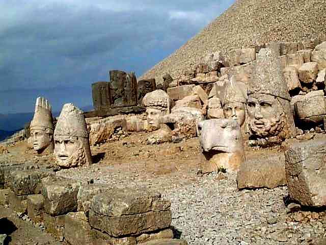
The fascinating thing about Nemrut Dagi is that it contains many huge statues, which dates back to 62 BC. King Antiochus I Theos of Commagene commissioned the building of the structures upon the mountain. Originally, the statues reached as much as 30 feet high, and these comprised of statues of the king, Armenian and Greek gods, lions, and eagles.

Anyone can take in the grandeur of the site, with the huge statues standing as sentinels to the mountain. However, Nemrut Dagi fell victim to iconoclasm; the statues’ heads are now scattered all over the mountain. Still, the site holds great significance, thus drawing in travelers who wish to learn more about this place’s history.

Believed to be the burial site of Antiochus, Nemrut Dagi leaves one in awe of the stone carvings that are more than 2000 years old. The statues exhibit the great skill that people back then had with building such structures. Going to see the ancient statues is a humbling experience, as it makes one feel part of something bigger.

Aside from the statues, the conical shape of the mountain where Nemrut Dagi stands is also something unique. Watching the sunrise and sunset from the summit is a great way to enjoy the sights of this wondrous place.


Nemrut Dagi
Nemrut Dagi
Nemrut Dagi

Natitingou

Natitingou

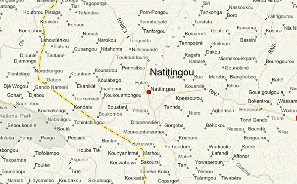
Discover the enigmatic wildlife a few miles outside Natitingou, Benin. Your travel destination for the year is of course nothing but Africa! You will be able to witness how it is to be with the wild and revel under the hot summer sun at its beautiful beaches. Should you be a little wary if you could run with the cheetahs, why not immerse yourself in the cool waters at the Falls of Tanougou?

There are other resorts within the vicinity that uses the waters that come from the falls. So you could enjoy basking under the sun with a little safety since you would not open in your eyes in shock that a little wild animal is swimming beside you. There happens to be an issue if the waters of Tanougou are potable. It would be advisable for you not to drink it to be sure. Although you can still bathe in it as long as you do not have open sore. Whenever you visit a new land, water happens to be issues so always pack some medicines for intestinal malfunction.

Aside from the waterworks, there is one sight that will make your eyes open wide in amazement – the mud castles of the Tata Somba. It is a little far about an hour’s drive but surely all worth the wait! You will definitely enjoy your visit at Natitingou, Benin for this. Heading back home would be a little difficult since this experience is worth every dollar you have saved for.


Natitingou
Natitingou
Natitingou Location Map

Naryn

Naryn

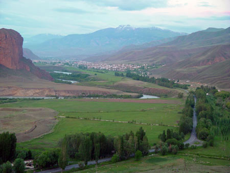
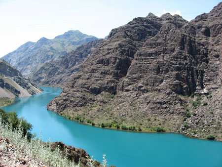
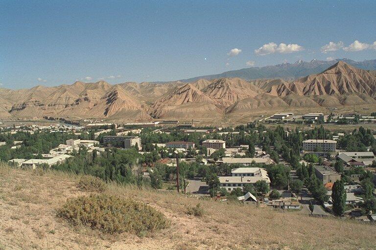
Kyrgyzstan is a country located at Central Asia. It is surrounded by other countries such as Kazakhstan, Uzbekistan, Tajikistan and China. Naryn is at the center of Naryn Province with five districts.

In the first district, Ak-Talaa, is the capital Baetov where you can travel towards the famous Torugart Pass going to China. The path here is sandy, almost like a desert, with lots of snow-coated mountain tops setting. Red, rusty orange, brown, light brown are the hues that cover the mountain’s body. At-Bashi, the second district, can be found on the southwestern town of Naryn. The site to see here is At-Bashi River that serves as a border from two countries. Jumgal and Kochkor districts on the other hand, also have bodies of water that connects to the main river. Tian-Shan, the last district, is the most populated district of all since 98% of Kyrgyz lives here.

The Tian-Shan Mountains are highly appreciated by writers and producers because of its incredible look especially right after winter season. Video games such as Indiana Jones and The Infernal Machine and Call of Duty: Modern Warfare 2 used this scenic spot as a field goal for their completing a quest. Son-Kul Lake is also an awe-inspiring view that can only be accessed from June to September through Sary-Bulak road. You might not want to stay here since accommodations are not available. But if you really want to spend a night here, you can just rent a private space from the neighborhood.
Now that you know this, get your visa and go to Naryn, Kyrgyzstan.


Naryn River by Artem Volkov
Naryn
Kyrgyzstan-Naryn Picture

Madaba

Madaba

Also known as the “City of Mosaics”, Madaba, Jordan is the first city you will come to when you go on a trip south of Amman though the 5000-year old King’s Highway. Passing through the ancient sites of the town is definitely one of the most memorable trips you could ever go on.

Madaba is very much like all the other East Bank towns aside from one exceptional aspect: underneath almost all its houses remains a Byzantine mosaic– all at their finest. Many of these mosaics have been excavated and displayed in the town’s museum.

When you visit Madaba, one site you should definitely explore is the contemporary Greek Orthodox St. George Church. Its sixth century Byzantine Mosaic map shows the whole region from Jordan to Palestine in the north and then Egypt to the south. Another spot to visit is the Archaeological Museum where you can find other mosaics portraying the scenes of mythology and the daily pursuits of the ancient people between the 5th and the 7th centuries.

Madaba, Jordan was ransacked by the Persians in year 614 and the earthquake of 747 completed its ruins. For over one thousand years, it was abandoned, until a group of about 2000 Christians in 1880 settled here. From then on, the process of rebuilding the town started.


The Madaba Mosaic Map web site
Madaba
Madaba Map

Guatemalan Quetzal

Guatemalan Quetzal

Quetzal is the currency of Guatemala, the most populous country in Central America. It is divided into 100 cents known as centavos in the Spanish language, or lenes in native Guatemalan. It is GTQ under the currency codes. It can be written as Q.

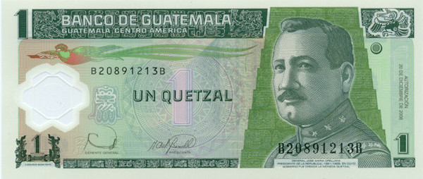
The Guatemalan quetzal was first used in 1925 during the regime of the then President Jose Maria Orellana. It replaced the peso which was the country’s official currency at that time. Coins with centavo denominations of 1, 5, and 10 were introduced as well as ¼ and ½, and the 1 quetzal coins. 2 centavo coins were introduced in 1932. 5-centavo coins and above were minted in 72% silver until 1965.

During those span of time, most of the 1 quetzal coins were dropped from circulation. However, in 1998 until 1999, ½ and 1 quetzal coins were made into circulation again. Currently, coins in general circulation are 1, 5, 10, 25 and 50 centavos coins, as well as 1 quetzal.

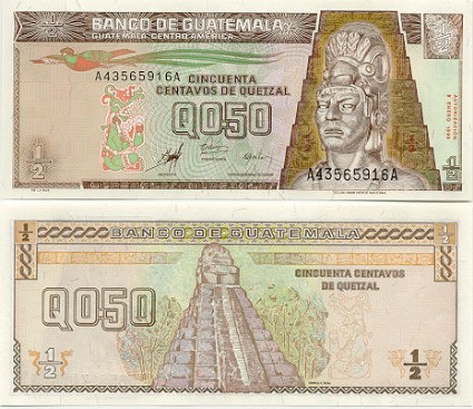
The issuance of Guatemalan Quetzal banknotes is the task of the country’s Central Bank. Denominations were 1, 2, 5, 10 and 20 quetzales. In 1933, the Central Bank added ½ quetzal notes. When the Bank of Guatemala gained control of banknotes issuance in 1946, the first issues were overprints on the previous notes issued by the Central Bank.

In 1967, 50 quetzales notes were introduced. In 2007, a polymer banknote of 20 quetzales was introduced. Current denominations in circulation are 1, 5, 10, 20, 50, 100 and 200 quetzales. In years to come, 500 and 1000 bills would be seen in circulation pending the approval of the congress.

Until 1987, the quetzal enjoyed strong exchange rate with the US dollar, with 1 quetzal equally pegged to 1 US dollar. The exchange rate for every US dollar is pegged at 7.77 quetzales.

The quetzal got its name after the national bird of Guatemala, which has the same name. Going back to the ancient Mayan culture, the feathers of the quetzal were used as currency.

Quite interesting with the quetzal notes were the reverse images, most of which contain allegories of things like coffee in 50 quetzales and marimba in 200 quetzales. These things have important contribution to the country’s history of development. Another interesting fact about quetzal notes is the representation of every note in Mayan numerals at the top right corner of the notes obverse face.


Guatemalan Quetzal GTQ
Guatemalan Quetzal
Guatemala Quetzal - Guatemalan

Girnar Temples in Junagadh

Girnar Temples in Junagadh

Girnar is located in the Junagadh region which is 327km from Ahmedabad (the largest city in Gujarat), in the state of Gujarat, India.

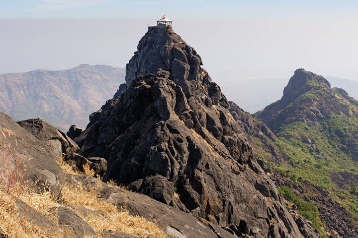
Since the 3rd century, Girnar has been a major religious place. Girnar is also a sacred place for Jains and the Hindus. Girnar Temples is known to be the “anthology of mountains” which contains about five mountains. The tallest among the mountains is 945 meters high. The first mountain contains Shwetamber and Digambar temples (Jain temples), these temples stand as a fine example in terms of architecture which portray the carvings on the temple structures.

There are almost 8,000 steps located from the starting point of the first peak to the very last shrine. Girnar is a sacred place for Jains and Hindus, which attracts a large number of pilgrims. The pilgrims climb all 8,000 steps barefoot as a belief that a person who climbs all the steps barefoot reaches Heaven.

The Neminath temple at Girnar is the major temple, which was built in the 11th century. The temple contains the deity of Lord Neminath, which is made of black granite and the eyes of the deity are made of precious jewels. The temple complex contains open space, courtyards, and several other minor temples. The temple roofs are inscribed with Goddesses in a dancing form. In addition, there is another temple known as Mallinath temple within the Neminath temple which is devoted to Tirthankar (Jain god). The temple was built in 1231 AD by Tejpal and Vastupal.

Besides these temples there are some minor temples namely Meravasi built in the 15th century. Married couples visit this temple to seek blessings. In addition, a mosque is located near the temple where childless women visit to enhance their fertility.

In the present day, Girnar is one of India’s biggest pilgrimage places. A race is conducted every year, the race involves climbing to the top of the 8,000 steps. A large number of people take part in it, and is the major attraction here.

Traveling
The nearby airport to Girnar is the Keshod airport, which is 40km from Girnar.

Traveling by train is the easiest way, train services are frequently available from Ahmedabad City.

From Junagadh daily services are available which is about 5km from Girnar, in addition the Gujarat state provides bus services from all the major parts of the state.


Jain temple on the way up
Girnar Temples in Junagadh
Girnar Temple Junagadh Gujarat

Kawai Nui Marsh

Kawai Nui Marsh

Kawai Nui Marshmay not be a usual spot for visitors to go to, but this area is of great importance to the many animal and plant species which can be found there. Majority of these species are endangered, such as the waterbirds which consider this wetland their sanctuary. Over the years organizations have fought to maintain the “untouched” nature of the marsh and prevented residential buildings from being built in the area. It appears that their efforts have all paid off.

The area has now been considered as a “Wetland of International Importance”, which sheds hope to the non-profit organizations which have sought to preserve the waterbird species found in the area. The Marsh currently has no walking trails or a visitor’s information center, but these are currently being built for the convenience of visitors. A levee currently serves as a makeshift trail which leads through the marsh and ends near the Pali Highway.

You can go on tours of the Kawainui Marsh. TheAhahui Malama I Ka Lokahiis an organization which has more details and information regarding the tours being conducted in the marsh. Volunteer work is also done in the marsh. Students and other volunteers help plant trees and other vegetation in the area to help improve the habitat of the waterbirds which live there.

The Kawainui Marsh is near theUlupo Heiau, which is a historical site that was used for ceremonies which were believed to help improve the development and planting of crops in the area. Now it is part of the National and Hawaii Registers of Historical Places.
These are two places in Hawaii where one can go to during their vacation. Hawaii isn’t just about sun, surf, and fun – there are places which value the life and history of the people in Hawaii and the animals which live in the country as well.


Kawai Nui Marsh
Kawai Nui Marsh
KAWAI NUI MARSH

Katunayake

Katunayake

With the hustle and bustle of everyday urban life, wouldn’t it be nice to just get away from it all? It is common that this time of the year, airlines would be fully booked for trips to Europe or other regular vacation spots. If you don’t want to get caught up with everyone else’s travel arrangements, why not try to visit a place like Katunayake.

At first, you might be reluctant to go here since it is not one of those places known to be a vacation spot. However, you might change your mind once you find see the things Katunayake has to offer.

A few places that you must visit are the wide-spanned beaches. Since the this region is found on the western part of the country, the currents might be too strong to surf or wind sail, but you can still swim in most parts and see the varieties of colorful coral reefs. Plus the weather is always perfect to go swimming since it is usually 25-30°C there. Most people visit during the months of April to September to maximize their Sri Lankan beach experience.

One of the reasons why most visitors visit this region is because of its proximity to the capital city of Sri Lanka, Colombo. It is relatively easy to get around, usually by Taxi if it is your first time there. The city itself is spacious but the inner streets are almost always jam packed. If you are looking for a reasonable hotel, most travelers recommend the Tamarind Tree Hotel which boasts of suites.


Katunayake a town is situated
Katunayake
Eelam - Katunayake Airport