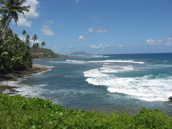
Across the Apolima Strait and twenty kilometers southeast of Savaii lay the island of Upolu. Among the islands of Samoa, Upolu is the second largest with a land area of roughly 1,115 square kilometers. Apia, the capital city of Samoa, is also located in this island which happens to be the most densely populated with a total population of 115,000.
The inlands of Upolu are rugged, tropical, and lush green. Its highest point is Mt. Fito that reaches 1,158 meters high. Year round, the season is relatively warm, with 29 degrees Celsius as its average maximum temperature. Between the months of November and March, rains may fall but from May to November, the season gets cooler again thanks to the trade winds from the south east.
The coast of Upolu is lined with many beautiful beaches, tumbling waterfalls, clear flowing rivers, traditional villages, and superb fringing reefs. Found in its interior are mountains and rainforests. The harbor of the northern coast of Upolu provides the main port of the country.
Visitors have the ability to take in the sights of Upolu because of the excellent network of roads there. Among the highlights of the island are the majestic mansion of Vailima that was once the home of the renowned author, Robert Louis Stevenson, and the Paola Deep National Marine Reserve that is lined by walls of colorful fish and corals. Also, Upolu offers Lake Lanotoo National Park and Le Pupu-Lue National Park that cater to nature lovers.
The other major attractions in the island include Lalomanu Crater Walk, Aleipata Coast, Sapoaga Falls, Fuipisia Waterfall, Piula Cave Pool, Togitogiga Falls, Sanupu and Satoa Conservation Areas, Peapea Cave, Papapapaitai Falls, and the south coast beaches. The most common activities done here by visitors are walking, diving, swimming, snorkeling, and surfing.

Upolu

No comments:
Post a Comment
Feel free to place you thoughts here